Episode 29: Madison Metro Transit

The unique geography of Madison, Wisconsin -- built on an isthmus, a narrow strip of land between two lakes -- creates an interesting bus service design. It's not quite narrow enough to put all buses on one street that everyone could walk to for very frequent service, but still there is frequent combined service on three corridors running the length of the isthmus. Like many agencies, Madison Metro Transit is struggling to manage steady growth in ridership. They were recently awarded the Outstanding Public Transportation Award for their efforts to improve and promote their service in innovative ways.  Marketing Director Mick Rusch joins me to discuss their services and some of the operational issues they deal with.

Bus routes and schedules are designed to facilitate connections at a series of transfer points at the edges of the city and downtown around the State Capitol. The most transit friendly city in Wisconsin has installed many transit priority facilities such as bus lanes and most notably a busway for the full length of the busy State Street pedestrian mall. The University of Wisconsin offers unlimited transit passes for their students, faculty and staff.

Metro Transit is struggling to deal with overcrowding and is even considering raising fares in order to increase service frequency. Would changing from a city department to a regional transit authority be the solution? Listen in to learn about bus-bike interaction, winter weather, bus technology and much more.

In the second half a listener shares a video on the structure of Singapore's bus and rail networks and suggests that privatized transit can only work well when heavily regulated. But if a public entity makes all the important decisions, is it still attractive to those who advocate for deregulation?  We also consider whether transit agencies should strive for profit, and suggests a way for the public sector to capture and reinvest some of increasing real estate values that their services facilitate.

Send your comments and suggestions for topics and/or guests by contacting me. Follow the blog at criticaltransit.com, and if this work is useful to you, please support the show to help me continue traveling and reporting.

Episode 28: The Vulture Space (Milwaukee Community Bicycle Project)

Enjoy my interview with Evan Pack, founder and director of the Vulture Space: Milwaukee Community Bicycle Project, a community bike shop focused on getting more people riding bikes more often. The shop sells inexpensive bikes, parts and accessories and provides the tools necessary for all kinds of people to learn and practice bicycle repair. Evan Pack is a Milwaukee native with a passion for long-term bike touring, when he's not busy helping other people get back on the road. Support this great community resource by donating money, parts, tools and accessories, and by becoming a member.  Find out more on website and Facebook page.

All of Evan's favorite bike coops and many more can be found on the Community Bicycle Organizations wiki compiled by the Bicycle Collective Network.

Other useful links: Milwaukee Bicycle Community; Amtrak bike policy (see also this bike packing video); Michael Horne's historic bikes (Milwaukee Magazine); South Shore Cyclery (donated equipment to Vulture Space and vintage bicycles to the Bike Federation); NPR affiliate WUWM on the Vulture Space opening (at the end) and their brief interview on Lance Armstrong; Ray's Indoor Mountain Bike Park; Milwaukee Bike Share (would be similar to Madison B-Cycle).

What Makes a Bike Friendly City? -- Madison, Wisconsin

As I hear people in the bike community talk about how cities like Portland and Minneapolis are very bike friendly, I’ve always wondered what that really means. Can cycling be fun, easy and stress-free when cars are still involved? I just spent a week in Madison, Wisconsin, a place many people consider to be among the most bike friendly cities in North America. It was quite likely the best place I’ve ever driven a bicycle.

It helps to understand that Madison is built on an isthmus -- a narrow strip of land between two lakes -- and is the progressive capital city of a state with a strong history of progressive politics. There are many housing and employee cooperatives in this city of 235,000 residents, as well as the main campus of the University of Wisconsin and Madison Area Technical College.

Madison benefits from a rare lack of freeways in its core and a limited parking supply as a result of its geography. These are two important long-standing incentives for people to try biking or transit when traveling into the city. So it is perhaps unsurprising that Madison was ahead of the curve when it developed its first bicycle transportation plan in 1975.

Today the city has bike lanes almost everywhere, a path/trail network running the length of the isthmus and along the lakes (complete with a “bike elevator” up to Capitol Hill), a two-year-old bike sharing system, contraflow bike lanes in many useful locations, bike boulevards, and a thriving bike/bus/pedestrian mall through the heart of downtown.

IMAG1281 IMAG1285 IMAG1360 IMAG1054

But I guess what it truly means to be a bike friendly city is that bikes are taken seriously as intended users of all streets in all stages of planning, design and construction. That means even very wide arterial streets are striped with wide bike lanes. One great setup is on University Ave along edge of the University of Wisconsin, a design which nicely accommodates all modes (though with too many car lanes) while purposely avoiding the conflict created when bikes and buses have to cross paths (top left). In the other direction a special left turn pocket (bottom left) puts you into a center bike lane (top middle) which continues straight into a contraflow protected bike lane (top right) while motor vehicles traffic curves to the right.  Very wide bike lanes in Capitol Hill (bottom center) and E Washington Ave (bottom right) keep you out of the door zone even when plowed snow takes up some room.

IMAG1222 IMAG1192 IMAG1209

IMAG1194 IMAG1368 IMAG1316

It also means that all bike routes are kept clear of snow and ice. While the number of bicyclists drops in the cold Wisconsin winters, there is still a steady stream of bikes on most corridors. (That may sound obvious, but far too many cities claim to support biking only to use bike lanes as places to pile snow all winter).

It’s not just the abundance of standard bicycle facilities. Madison has installed a number of excellent infrastructure that you won’t find in a traffic engineer’s toolkit. It’s also the way in which these facilities are treated, often with few or no stop signs and with special treatments made to conflict points such as intersections and non-standard situations.

As a city becomes more bike friendly, more people try getting around by bike, which gives biking a legitimacy that it doesn’t have in most places. Car driver behavior is noticeably better because many drivers also bike sometimes or at least have friends who bike. I’ve seen many people hauling trailers and at least a handful of children riding their own bikes in the street.

IMAG1363 IMAG1236 IMAG1233

It’s important not to forget the bus system, Madison Metro Transit (which I’ll be posting about soon). Aside from bike racks, bus drivers receive extensive training on interacting with bicyclists in different environments and must ride bikes in traffic situations so they can fully understand the other perspective. It makes a big difference when you don’t have to worry about whether that large approaching vehicle is about to squeeze you into the curb.

A few opportunities remain, such as directional signage and improving the condition of railroad tracks at grade crossings, but overall I had a wonderful time as Madison has a relaxed pace of life and is easy to getting around.

Episode 27: Bicycle Federation of Wisconsin - Milwaukee

On the last bitter cold morning of the year I stopped by the Milwaukee office of the Wisconsin Bike Federation to learn about their efforts to improve bicycling across the state. Their education programs are a model for bike advocacy organizations looking to teach safe cycling skills to new cyclists of all ages. They are working to bring complete street designs to Wisconsin cities and towns and foster an already impressive bike culture.  Thanks to Communications Director Dave Schlabowske; Education Director (and soon-to-be Milwaukee chapter leader) Jessica Binder; and Education Project Manager (and bike polo master) Jake Newborn, for sharing all this great info. Follow the blog and learn about how you can help, and attend their Lobby Day on Tuesday, April 9 to help restore bike funding and promote legal protections for vulnerable road users. And if you become a member you get the shiny new magazine you heard about in the interview.

Also check out the Urban Ecology Center right next door, and have a look around the City of Milwaukee bike pages.

Ramp metering could make transit priority on city streets easier

Ramp metering (wiki) seems to be a common practice at freeway entrances in Wisconsin. The concept is simple: by allowing vehicles onto the highway in small numbers, you can reduce traffic up ahead as well as improve safety by reducing the friction caused by merging traffic. In the event of an emergency, holding traffic back away from the scene reduces the number of interfering cars that first responders have to deal with.

Street metering could be very useful in cities with limited space. Since traffic engineers primarily concern themselves with traffic flow, one thing they focus on is storage: space for vehicles to wait during a red signal phase or for turns. If you metered the traffic coming into a busy area, you wouldn't need as much storage in areas without excess room.Those of us who always hear the tired lie that "there's no room" for bike or transit priority -- there is always room unless you give car priority -- might think about how metering could reduce the storage engineers say they "need" in specific locations. So you can have your protected bike lane in the narrow road section as long as not as many cars are allowed to queue there.

As a transit priority measure, metering could be used in advance of a bottleneck such as a bridge or business district, allowing buses to pass stopped cars in a bus lane or shoulder and move in front where the street is clear. Think of it as a queue jump where traffic is held for a minute or two whenever the bus is detected as approaching. A meter could also be used at an intersection with a transit corridor so that buses and streetcars don't deal with as much traffic.

Do you know any current examples of metering on city streets?

Milwaukee, Wisconsin

It's been an interesting week here in Milwaukee. The empty streets reflected the bitter cold earlier this week but by now more people are out and the weather is showing signs of spring. Still, it feels like a small city and is much less dense than than I expected a city of 600,000 people to be. When everyone came out of hiding from the cold I could tell that most people drive private cars -- in fact, census data shows that only 4 percent of commute trips are made by transit, and less than 1 percent by bike -- yet I found it easy to get around without a car.

Bikes

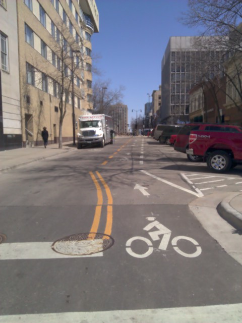
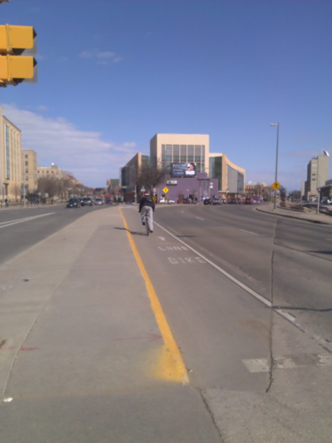
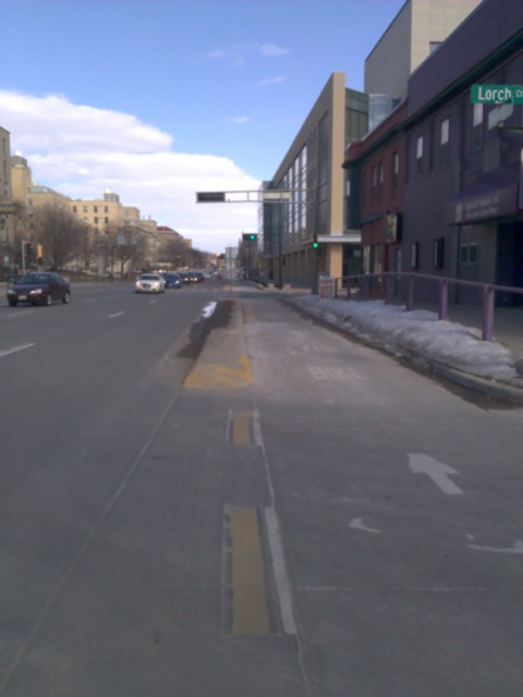
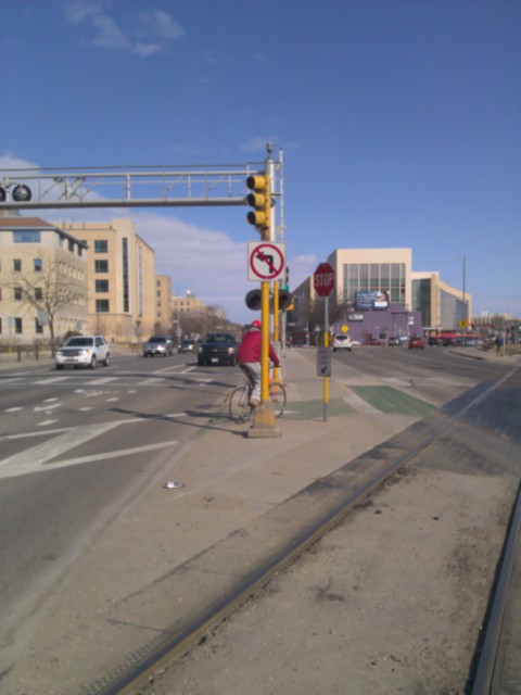
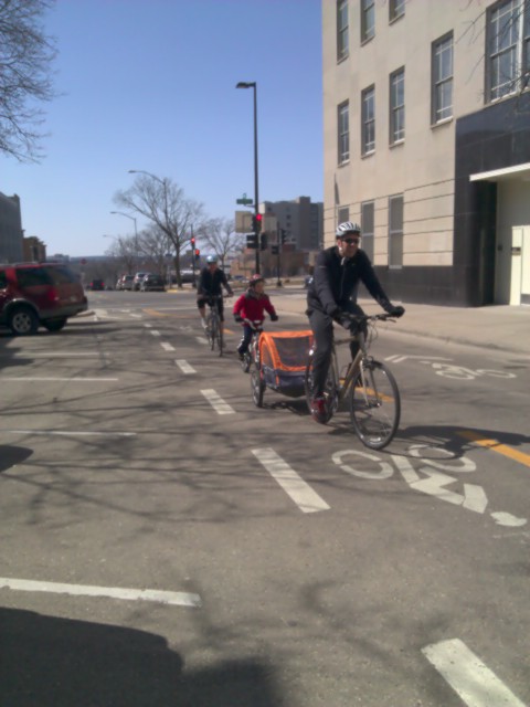
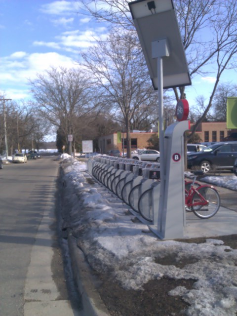
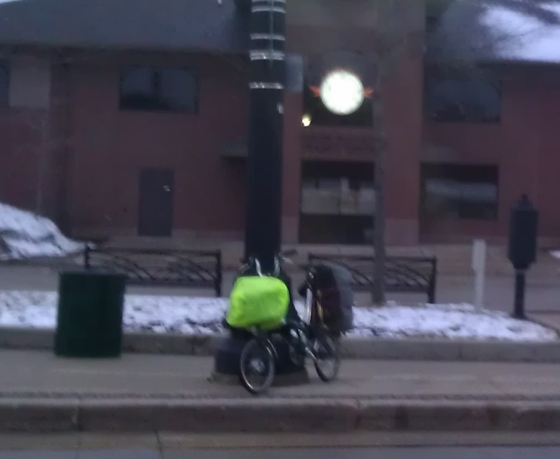
The city owes a lot of its success to the many breweries, and that's reflected in the thriving bike culture, with a wide variety of simple, utilitarian bicycles.  Bike lanes exist on many streets but Milwaukee would be so much better to bike in if the pavement condition were improved. Many streets are surfaced with concrete, which holds up well to stress from heavy vehicles but fails miserably with the freeze-thaw cycles.

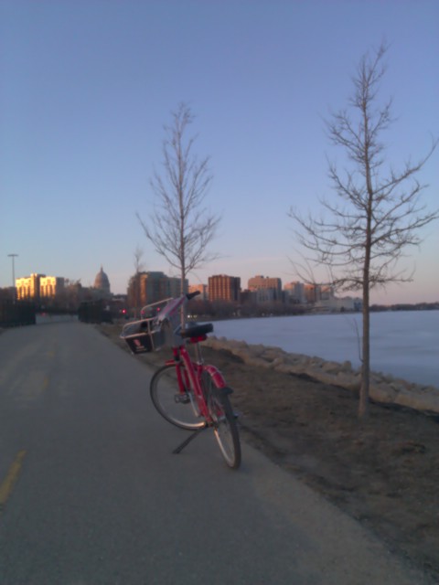
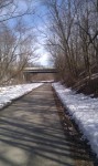
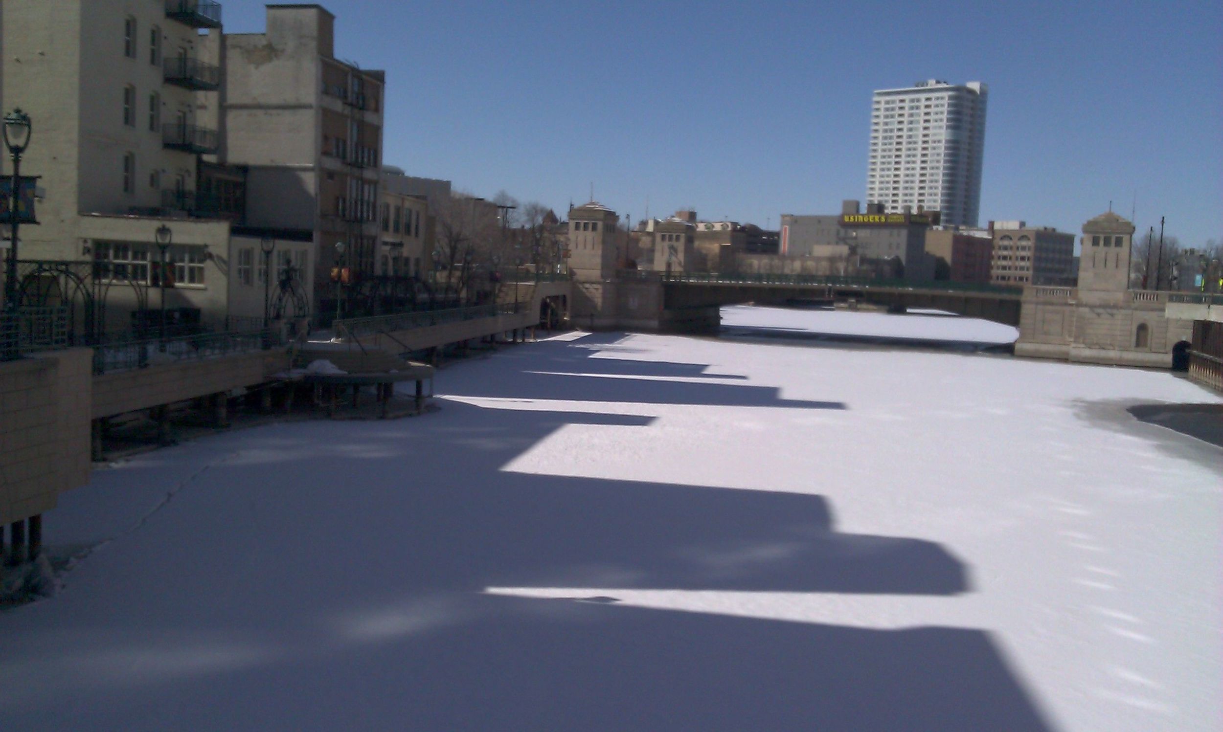
While there are several pleasant and useful bike paths, winter maintenance continues to be a problem, with many trails at least partly covered with snow and ice. It is possible to ride most of the Oak Leaf Trail along Lake Michigan and north or south from downtown (minus the ice rinks), the Hank Aaron State Trail west (continuing some 80 miles to Madison once snow melts), and the scenic and flat Riverwalk along the Milwaukee River.  Lakeshore State Park is the only state park in a Wisconsin city; it's a nice place to relax even if it is separated from the city (as in most cities) by an underused highway.

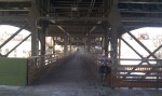
The many bridges offer great views of the Milwaukee River valley, and the Riverwalk abuts many new apartment buildings.  Not to be missed is the Marsupial Bridge, constructed in 2006 directly under the deck of an existing bridge, exclusively for pedestrians, bikes and other non-motorized vehicles. Aside from the pleasant ride, it's footprint is a reminder of how space-efficient bikes is compared to the cars above.

I had the pleasure of interviewing the Wisconsin Bike Federation staff as well as the director of the Vulture Space community bike shop; you can listen to those on separate podcast episodes this week.

Local Transit

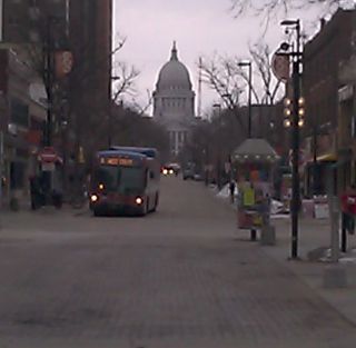
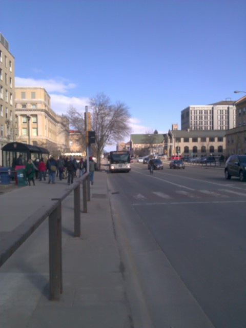
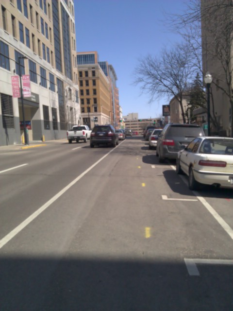
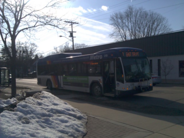
Bus service in Milwaukee is provided by the Milwaukee County Transit System. Most lines run along Wisconsin Avenue through the downtown area (known as Westown and Easttown on either side of the river). That's the main street and although it's overly wide and not really pedestrian friendly, it is nice to be able to board any bus within a few minutes at most times for a short ride east or west. Many bus routes go all the way east (across a highway from the lake) and terminate at the Downtown Transit Center, so isolated and depressing that passengers just transfer along Wisconsin Avenue. The county is trying to sell it to a developer, and if successful it should use the proceeds to remove a lot of the excess road space and create linear parks with street furniture and amenities.

In recent years MCTS upgraded three routes to crosstown limited-stop services (Red, Green & Blue Lines) which have no traffic priority measures but seem to be well used.  They recently released an excellent mobile web site.  But their best feature: after paying the fare you may request a free transfer which can be used as many times as you wish, even on the same route, for up to one hour. I've been a big proponent of this kind of policy since I first saw it in San Francisco as it allows people to use transit however it works best for them -- need to make a quick stop? forgot something? change of plans? maybe your child needs a bathroom break? -- but here it has become a political issue. A proposal to eliminate free transfers to combat perceived fare evasion (passengers selling transfers, though probably not as often as perceived) was recently rejected by the county as MCTS plans to implement an automated fare collection system using contactless smart cards later this year.

Like other county services, MCTS has been subjected to large service cuts and fare increases in recent years as the car-obsessed Republican Scott Walker -- who says we can't afford transit but always finds new money for highways -- was the County Executive here before becoming the Governor of Wisconsin.

The light traffic on city streets means that buses run well since there's not much to delay them, but also that ridership is relatively low because there is no real incentive to take the bus instead of driving. This is also evident in the very light foot traffic on most streets. The downtown is full of car parking garages and the east-west freeway cuts off the downtown just a few blocks south of Wisconsin Avenue.

Intercity & Regional Transit

Southeastern Wisconsin has a patchwork of transit services which connect in a somewhat complicated way.  The cities - Milwaukee, Waukesha, Racine, Kenosha - each operate their own transit systems. MCTS Route 10 connects to Waukesha Metro Route 1 at a shopping mall in the midway town of Brookfield. The other links are provided by the subsidized Wisconsin Coach route from Milwaukee to Racine and Kenosha, for which a maximum fare is $4.50 is charged. You can transfer at Kenosha for one of a handful of daily Metra trains south to Chicago.

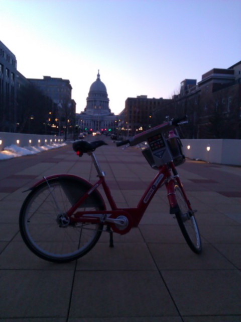
The new Milwaukee Intermodal Station provides access to Amtrak trains to Chicago, including the daily Empire Builder train to Minneapolis and all the way to the west coast, as well as intercity buses in all directions. Like many such facilities, it is close to downtown but not right there.

On Monday I will take the Badger Bus - the only regular scheduled intercity bus that doesn't stop at the Intermodal Station - to Madison for a few days before taking another bus to La Crosse, where I'll start riding along the Mississippi River toward Minneapolis.

Episode 26: Streetsblog Chicago

My last show from Chicago features sustainable transportation advocates, and Streetsblog Chicago editors Steven Vance & John Greenfield.  Streetsblog is a daily news source covering public transit, bicycling, walking and the growing movement for safe, equitable, livable streets.  Their original site remains at Grid Chicago and their individual blogs are Steven Can Plan and Vote With Your Feet. Links to Chicago DOT, Active Transportation Alliance, the Ventra fare card (Chicago Transit Authority), Chicago Cargo (bike swap photos). I am now in Milwaukee, Wisconsin after completing a multimodal trip by train, bike and bus, which I discuss later in the show.  The coldest days seem to be behind us but it still won't feel like spring in this region for another two weeks.  From here I will spend a few days in Madison and continue northwest making my way up to Minneapolis & St. Paul, Minnesota.

If you find yourself along my route please contact me to share information, suggest places to go or people to talk to, and hopefully meet to discuss transit and bikes.  And if you appreciate the show please consider donating to help support my Sustainable Transport Tour and this reporting. You can also support this work by sharing it with your friends and colleagues, following me on Facebook and Twitter, and leaving a review on iTunes or another blog/podcast service.

P.S.  I have been working on the site to fix some issues and make it load faster.  Please contact me if you have suggestions for improvements, if you experience difficulty accessing the site, or if your comments don't appear after you post them (sometimes real comments get stuck in the spam folder).

Day 1: Chicago to Milwaukee

Yesterday I left Chicago on a multimodal trip that would take me to Milwaukee. It's actually possible to make the whole trip on local transit without a bike, but only a few trains on the Metra North Line actually extend the entire way to Kenosha, Wisconsin, the southern terminus of the regional bus to Milwaukee.  The train I took ended in Waukegan, Illinois, about 17 miles south of Kenosha. While there is a bike path from Waukegan (actually almost all the way from Evanston & Chicago) into the edge of Kenosha, it seemed to be treated as recreation instead of transportation, just as in many other places. Without a serious mountain bike I can handle packed snow but not the ice underneath.

IMAG0828-2

I would often travel a few miles and try to find a better route, riding some distance before winding up in a residential subdivision with no way out -- things I tend to forget even exist -- and back on a four-lane suburban arterial highway.  Finally I went west to find a two-lane rural road with moderate traffic and at least a half-decent shoulder to ride on. Sadly there was no sign welcoming me to Wisconsin, but some highway route signs and finally a Kenosha Transit bus stop sign informed me I had entered the city of Kenosha. The ride from there was less than pleasant as all of the streets were paved with deteriorated concrete. I don't know why a northern city with freeze-thaw cycles would choose concrete over asphalt.

Shortly after 6pm, after logging over 30 miles on what should have been a 15-mile trip, I reached the Kenosha Transit Station. The beautiful building was closed which was closed but there was still one more scheduled local bus departure at 7. This is a pulse point, where all buses arrive and depart together to facilitate easy, reliable connections; buses will wait a few minutes if another bus is late. There is also a historic streetcar line which stops in front of the transit center and does a short on-street loop for tourists during limited hours.  Maybe I'll come back in a few days.

IMAG0848 IMAG0856 IMAG0853

I removed my gear, folded my bike and boarded the Wisconsin Coach bus to Milwaukee, for only $4.50 with a tour of Racine included. Although it was a coach bus, it made local stops in the cities and along the highway in between. A detour to the University of Wisconsin at Parkside (between Kenosha & Racine) yielded no passengers. In under two hours we arrived at the very sterile, airport-style Milwaukee Intermodal Station, which serves Amtrak trains heading northwest west from Chicago as well as express buses from Chicago, Minnesota, Michigan and other cities in Wisconsin. Most local transit systems in Wisconsin are very small but the intercity bus network connects the cities well and is likely subsidized by the state. (The map really helps with trip planning.)

I am staying in Milwaukee for about a week as I learn about the city and it's transportation and culture. I look forward to interviewing the great people of Bike Fed Wisconsin very soon.

Highway Transit

As cities look to expand transit, it's common to use an existing transportation corridor on which extra ground level space is available. Many cities have built rapid transit and regional rail and bus lines in the median of a highway, and many others continue to do so because it's cheap and has only minimal impacts. Aside from the cost, freeway corridors can be great places for long-distance express buses or trains with either no stops or just a few park-and-ride stations.  However, it's not a good place for any other transit service. My experience on Chicago's Blue Line provides a clear case against locating transit stations along a highway.

Just the presence of the highway ensures that walkable neighborhoods will not develop, and any nearby businesses will be hostile to pedestrians. The location of the station means that a long, unpleasant walk is required from the train to anything else. And since the highway divides communities, the lack of street life makes it not only uncomfortable but also potentially unsafe.

IMAG0487 IMAG0482 IMAG0495

Once you reach the platform, you're still exposed to high health risks from auto emissions, not to mention the discomfort caused by noise and the nauseating feeling of traffic whizzing by within a few meters of where you're standing. Not a nice place to be waiting, and certainly not a good way to attract riders and promote public transit.

IMAG0734

There is often a tendency to be lazy and build a transit line along a highway simple because there is room and it's relatively cheap and easy to do. Yet before we take that plunge, let's think hard about what kind of ridership you expect to be serving, as highways and rapid transit lines promote very different kinds of land use.

Rapid transit stations have the potential to attract dense, pedestrian friendly mixed-use development that people will walk to and spend time hanging around.  But highways are usually more powerful in dividing communities and creating hostile walking environments. Next to most highways you typically warehouses, auto repair shops, parking lots and other things that don't create much street life.

While highway transit may be better than nothing at all, I think it's well worth the extra cost and construction impacts to locate rapid transit lines and stations either in existing dense areas in need to better transit or in places with the potential to become walkable, thriving neighborhoods.

Fortunately, CTA seems to recognize this as they have decided that the planned extension of the Red Line's southern portion (also in an expressway median) will move away from the highway.

Episode 25: The Chainlink Chicago bicycling online community

I chat with Julie Hochstadter, director of The Chainlink, an online forum which serves as a community and resource hub for bicyclists in Chicago.  We hear about how members have used The Chainlink to address a diverse range of issues and discuss bike advocacy, politics, infrastructure and the state of cycling in the city. Julie offers some ride suggestions and tips for both new and seasoned cyclists. This past weekend I attended the Chicago Bike Swap, where I had the chance to test ride cargo bikes (PICS!) and meet many interesting people. Links include the Cargo Bike Roll Call; a mobile bike repair shop called Pedal to the People; and the sustainable streets blog Streetsblog Chicago. Pictures coming soon!

Next week I will be in Milwaukee as I tour cities in Wisconsin, Minnesota and eventually Michigan.  Get in touch - feedback@criticaltransit.com - if you're in those states area or have suggestions for show topics, places I should go, or people I should meet or interview.

If you benefit from my work, please consider supporting my Sustainable Transport Tour by donating on the Indiegogo campaign page and sharing it with your friends and colleagues. Follow my work on Facebook at Twitter, share your thoughts, and pass it around.